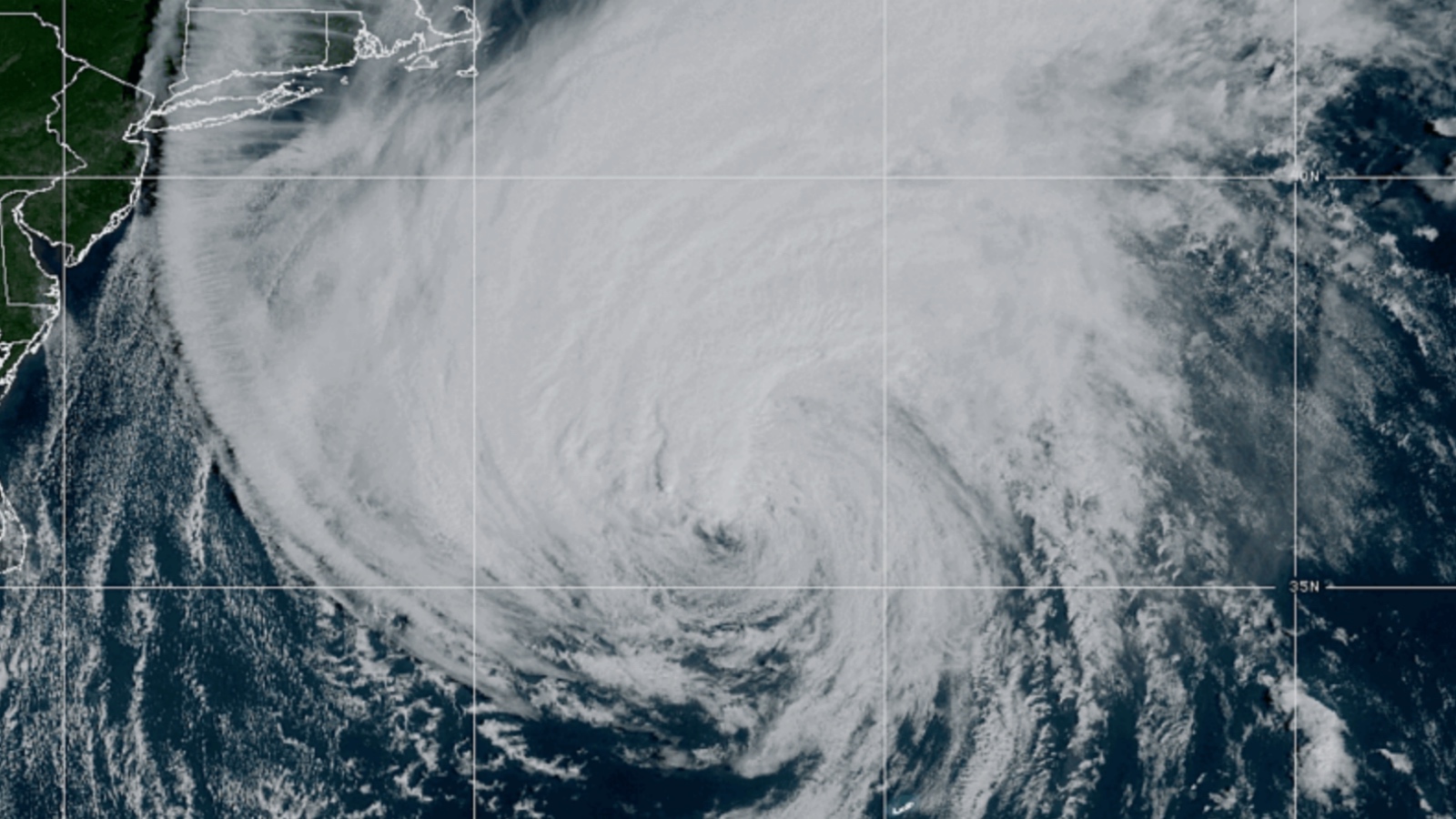
Hurricane Lee is a storm of epic proportions and though it’s weakening now it was at one point 640 miles wide with a 210-mile diameter of hurricane-force winds. That is absolutely massive as far as hurricanes go and NOAA hurricane hunters didn’t want to miss the opportunity to study this storm.
Meteorologist Ginzer Zee (real name Ginger Renee Colonomos) was fortunate enough to fly into the heart of Hurricane Lee with a team of NOAA hurricane hunters. While the journey was nearly 8 hours, her video of just over 4 minutes shows what it’s like flying inside of a tropical cyclone.
Hurricane Hunters Fly Into Hurricane Lee To Study The Storm
The National Oceanic and Atmospheric Administration (NOAA) plane that meteorologist Ginger Zee was invited on is named ‘Kermit’. They also fly with a plane named Miss Piggy. These are two of the custom-built NOAA hurricane hunter planes. Here is her experience:
@gingerzee Fly into a HURRICANE with me. I got the chance to go with NOAA hurricane hunters INTO hurricane Lee! Watch for all the science, adventure and yeah a little air sickness 😉😂🙌 #hurricane #lee #hurricanehunters #eyewall #science #dropsonde #drone #kermit #p30
YouTube version:
There were 17 ‘hurricane hunters’ on the plane, each with a unique role. Everyone wore survival vests onboard in case the plane had to be abandoned at any point. In total, there are 19 seats and stations for each role.
Personally, my favorite aspect of this plane is the tube they have to just drop expensive pieces of high-tech equipment into the middle of category-5 hurricanes to take various readings. I wasn’t aware they were dropping sensors into storms like this until seeing this video.
We are still hours/days out from New England and Nova Scotia feeling the full force of Hurricane Lee. Fortunately, it is weakening some on the northern trek toward Halifax but the expected damage is still predicted to be enormous. And the potential storm surge in the Bay of Fundy is unlike anything people can predict.
The Bay of Fundy has the highest tidal surge of anywhere on earth with a 52 foot swing between high tide and low tide. Predicting what a massive storm surge from a category-3 hurricane could do to that isn’t something meteorologists have ever had to tackle before.