[vision id=”49″]
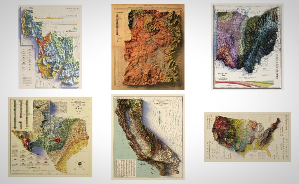
These early 1900s relief maps are here to have your bachelor pad or man cave looking better than ever. But let’s start by defining what relief maps even are. They are raised terrain maps that represent things like mountains and valleys on some sort of exaggerated relative scale. Relief Maps look awesome and they illustrate regions that are near and dear to us.
That image above is interactive. There are also links below that correspond to each individual map. These come from Muir Way, are printed in California using archival, museum-quality paper using a 12-color giclée printer. To purchase any of these you can follow those links below. And to learn more about any of the individual maps you can click the corresponding link!
[1] 1987 Zion Relief Map [$79]
[2] 1878 Yellowstone Relief Map [$99]
[3] 1920 Ohio Relief Map [$89]
[4] 1916 Texas Relief Map [$89]
[5] 1944 California Relief Map [$99]
[6] 1932 USA Geological Relief Map [$149]
Cass is a partner at BroBible and he’s been found here for the better part of a decade. He’s based out of Florida and you can contact him on Twitter at @casspa or via email cass@brobible.com
The BroBible team writes about gear that we think you want. Occasionally, we write about items that are a part of one of our affiliate partnerships and we will get a percentage of the revenue from sales.